Lost password? New user? Register
Clownfish, Philippines. Photo by Stephane Rochon.
Enjoy and contribute!
| Find the best dive sites |
|
|
 Cook Islands
Australia & Pacific
Location: Oceania, group of islands in the South Pacific Ocean, about one-half of the way from Hawaii to New Zealand
Geographic coordinates: 21° 14' S, 159° 46' W
Coastline km: 120 km km
Climate: tropical oceanic; moderated by trade winds; a dry season from April to November and a more humid season from December to March
Terrain: low coral atolls in north; volcanic, hilly islands in south
Elevation: lowest point: Pacific Ocean 0 m
highest point: Te Manga 652 m
Natural hazards: typhoons (November to March)
Currency: NZ dollar (NZD)
Population: 21,750 (July 2007 est.)
Languages: English (official), Maori
Capital: Avarua
Divisions:
More details
| Jan | Feb | Mar | Apr | May | Jun | Jul | Aug | Sep | Oct | Nov | Dec | |
|---|---|---|---|---|---|---|---|---|---|---|---|---|
| Climate | ||||||||||||
| Air temp. | ||||||||||||
| Water temp. | ||||||||||||
| Equipment | Keine Ahnung | Keine Ahnung | Keine Ahnung | Keine Ahnung | Keine Ahnung | Keine Ahnung | Keine Ahnung | Keine Ahnung | Keine Ahnung | Keine Ahnung | Keine Ahnung | Keine Ahnung |
| Best season | ||||||||||||
Additional map
Wanna add some info about Cook Islands? Let us know...
This is an interactive map! Use controls to pan and zoom this map.

- Favourite
-
Your favourites and future dive site lists
Your favorite zone isn't listed ? Add a zone
Zones
| Zones (2) | Dive sites | Sub zones |
|---|---|---|
| Aitutaki | 1 | 0 |
| Rarotonga | 4 | 0 |
 Photos
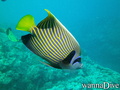
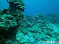
Aruntanga Passage |
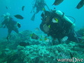
Aruntanga Passage |
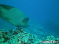
Aruntanga Passage |
Alberto s |
Comments
Errors, Feedback
If you want to add new information or you have found errors on this country, Send us feedback.
Advertise
Wannadive.net 24/24
Wannadive.net on your mobile
![]()
RSS All the RSS feeds of Wannadive.net
Newsletter All news by email