Lost password? New user? Register
Whale Shark, Philippines. Photo by Stephane Rochon.
Enjoy and contribute!
| Find the best dive sites |
|
|
 Federal State of Micronesia
Australia & Pacific
Location: Oceania, island group in the North Pacific Ocean, about three-quarters of the way from Hawaii to Indonesia.
Geographic coordinates: 6° 33' N, 158° 9' E
Coastline km: 6,112 km km
Climate: tropical; heavy year-round rainfall, especially in the eastern islands; located on southern edge of the typhoon belt with occasionally severe damage
Terrain: islands vary geologically from high mountainous islands to low, coral atolls; volcanic outcroppings on Pohnpei, Kosrae, and Chuuk
Elevation: highest point: Dolohmwar (Totolom) 791 m
Natural hazards: typhoons (June to December)
Currency: US dollar (USD)
Population: 108,105 (July 2005 est.)
Languages: English (official and common language), Trukese, Pohnpeian, Yapese, Kosrean, Ulithian, Woleaian, Nukuoro, Kapingamarangi
Capital: Palikir
Divisions: 4 states; Chuuk (Truk), Kosrae (Kosaie), Pohnpei (Ponape), Yap
More details
| Jan | Feb | Mar | Apr | May | Jun | Jul | Aug | Sep | Oct | Nov | Dec | |
|---|---|---|---|---|---|---|---|---|---|---|---|---|
| Climate | ||||||||||||
| Air temp. | ||||||||||||
| Water temp. | ||||||||||||
| Equipment | ||||||||||||
| Best season | ||||||||||||
Additional map
Wanna add some info about Federal State of Micronesia? Let us know...
This is an interactive map! Use controls to pan and zoom this map.
- Favourite
-
Your favourites and future dive site lists
Your favorite zone isn't listed ? Add a zone
Zones
| Zones (5) | Dive sites | Sub zones |
|---|---|---|
| Guam | 7 | 0 |
| Kosrae | 1 | 0 |
| Pohnpei | 10 | 0 |
| Truk Lagoon | 16 | 0 |
| Yap | 20 | 0 |
Dive sites
| Dive sites (2) | Quality | Avg depth | Max depth | Experience | Dive type | ||
|---|---|---|---|---|---|---|---|
| Lelu Aeroplane | - / - | 65.6 ft | 114.8 ft | CMAS * / OW | 

|
||
| Lelu Wrecks | - / - | 59.1 ft | 98.4 ft | CMAS * / OW |
|
 Photos
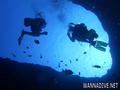
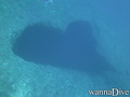
Blue hole |
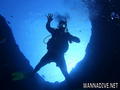
Blue hole |
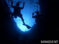
Blue hole |
Blue hole |
Dive logs
|
Comments
Errors, Feedback
If you want to add new information or you have found errors on this country, Send us feedback.
Advertise
Wannadive.net 24/24
Wannadive.net on your mobile
![]()
RSS All the RSS feeds of Wannadive.net
Newsletter All news by email